31.12.2015
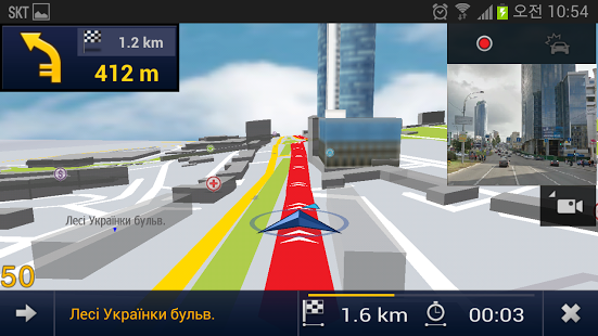
An updated version of E2M Carte Blanche Ukraine: GPS for Android with CarteBlanche Ukraine map 2015.06 is available on Play Store. The update is free for all legal users.
As compared to the previous 2014.12 map version, the changes in the new version are as follows:
Therefore, now CarteBlanche Ukraine map 2015.06 contains a detailed coverage of 938 settlements (53.5% of the Ukrainian population), including 184 cities; almost all of this coverage (46,9% of population) includes address search. The map features a detailed coverage of all settlements in 11 districts of Kyivs'ka oblast' (Bilotserkivs'kyi, Borodians'kyi, Boryspil's'kyi, Brovars'kyi, Kaharlyts'kyi, Kyievo-Sviatoshyns'kyi, Makarivs'kyi, Obukhivs'kyi, Pereiaslav-Kmel'nyts’kyi, Vasyl'kivs'kyi and Vyshhorods'kyi), in-block passages in many cities. The total length of road coverage is 476 400 km, including a large number of unpaved roads.
We thank our customers once again for the feedback and ideas on how to improve the map. Suggestions that were not taken into account in this version of the map will be considered in the next releases.
09.09.2015
We are glad to announce the release of 2015.03 CarteBlanche Ukraine map version for CarteBlanche Navigator, iGO 8 and iGO Primo applications!
As compared to the previous 2014.09 map version, the changes in the new version are as follows:
Therefore, now CarteBlanche Ukraine map 2015.03 contains a detailed coverage of 936 settlements (53.6% of the Ukrainian population), including 182 cities; almost all of this coverage (46,9% of population) includes address search. The map features a detailed coverage of all settlements in 11 districts of Kyivs'ka oblast' (Bilotserkivs'kyi, Borodians'kyi, Boryspil's'kyi, Brovars'kyi, Kaharlyts'kyi, Kyievo-Sviatoshyns'kyi, Makarivs'kyi, Obukhivs'kyi, Pereiaslav-Kmel'nyts’kyi, Vasyl'kivs'kyi and Vyshhorods'kyi), in-block passages in many cities. The total length of road coverage is 476 000 km, including a large number of unpaved roads.
Legal users of CarteBlanche Navigator, iGO 8 and iGO Primo software can download the new map version from NNG official map update portal, www.naviextras.com. The portal is available in 10 languages, including Ukrainian.
We also thank our customers once again for the feedback and ideas on how to improve the map. Suggestions that were not taken into account in this version of the map will be considered in the next releases.
31.05.2015
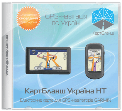
We are glad to announce that the 2015.03 version of Carte Blanche Ukraine NT map is now available for Garmin® and Kenwood® navigation devices!
As compared to the previous 2014.03 map version, the changes in the new version are as follows:
Therefore, now CarteBlanche Ukraine map 2015.03 contains a detailed coverage of 936 settlements (53.6% of the Ukrainian population), including 182 cities; almost all of this coverage (46,9% of population) includes address search. The map features a detailed coverage of all settlements in 11 districts of Kyivs'ka oblast' (Bilotserkivs'kyi, Borodians'kyi, Boryspil's'kyi, Brovars'kyi, Kaharlyts'kyi, Kyievo-Sviatoshyns'kyi, Makarivs'kyi, Obukhivs'kyi, Pereiaslav-Kmel'nyts’kyi, Vasyl'kivs'kyi and Vyshhorods'kyi), in-block passages in many cities. The total length of road coverage is 476 000 km, including a large number of unpaved roads.
We thank our customers once again for the feedback and ideas on how to improve the map. Suggestions that were not taken into account in this version of the map will be considered in the next releases.
17.04.2015
An updated version of E2M Carte Blanche Ukraine: GPS for Android with CarteBlanche Ukraine map 2014.12 is available on Play Store. The update is free for all legal users.
As compared to the previous 2014.03 map version, the changes in the new version are as follows:
Therefore, now CarteBlanche Ukraine map 2014.12 contains a detailed coverage of 933 settlements (53.5% of the Ukrainian population), including 179 cities; almost all of this coverage (46,6% of population) includes address search. The map features a detailed coverage of all settlements in 11 districts of Kyivs'ka oblast' (Bilotserkivs'kyi, Borodians'kyi, Boryspil's'kyi, Brovars'kyi, Kaharlyts'kyi, Kyievo-Sviatoshyns'kyi, Makarivs'kyi, Obukhivs'kyi, Pereiaslav-Kmel'nyts’kyi, Vasyl'kivs'kyi and Vyshhorods'kyi), in-block passages in many cities. The total length of road coverage is 475 800 km, including a large number of unpaved roads.
We thank our customers once again for the feedback and ideas on how to improve the map. Suggestions that were not taken into account in this version of the map will be considered in the next releases.
16.04.2015
We are glad to announce the release of 2014.09 CarteBlanche Ukraine map version for CarteBlanche Navigator, iGO 8 and iGO Primo applications!
As compared to the previous 2014.03 map version, the changes in the new version are as follows:
Therefore, now CarteBlanche Ukraine map 2014.09 contains a detailed coverage of 931 settlements (53.4% of the Ukrainian population), including 178 cities; almost all of this coverage (46,6% of population) includes address search. The map features a detailed coverage of all settlements in 11 districts of Kyivs'ka oblast' (Bilotserkivs'kyi, Borodians'kyi, Boryspil's'kyi, Brovars'kyi, Kaharlyts'kyi, Kyievo-Sviatoshyns'kyi, Makarivs'kyi, Obukhivs'kyi, Pereiaslav-Kmel'nyts’kyi, Vasyl'kivs'kyi and Vyshhorods'kyi), in-block passages in many cities. The total length of road coverage is 475 600 km, including a large number of unpaved roads.
Legal users of CarteBlanche Navigator, iGO 8 and iGO Primo software can download the new map version from NNG official map update portal, www.naviextras.com. The portal is available in 10 languages, including Ukrainian.
We also thank our customers once again for the feedback and ideas on how to improve the map. Suggestions that were not taken into account in this version of the map will be considered in the next releases.
13.02.2015
An updated version of Mireo DON'T PANIC 4.7.7 with CarteBlanche Ukraine map 2014.09 is available on Play Store. The update is free for all legal users.
As compared to the previous 2013.12 map version, the changes in the new version are as follows:
Therefore, now CarteBlanche Ukraine map 2014.09 contains a detailed coverage of 931 settlements (53.4% of the Ukrainian population), including 178 cities; almost all of this coverage (46,6% of population) includes address search. The map features a detailed coverage of all settlements in 11 districts of Kyivs'ka oblast' (Bilotserkivs'kyi, Borodians'kyi, Boryspil's'kyi, Brovars'kyi, Kaharlyts'kyi, Kyievo-Sviatoshyns'kyi, Makarivs'kyi, Obukhivs'kyi, Pereiaslav-Kmel'nyts’kyi, Vasyl'kivs'kyi and Vyshhorods'kyi), in-block passages in many cities. The total length of road coverage is 475 600 km, including a large number of unpaved roads.
We thank our customers once again for the feedback and ideas on how to improve the map. Suggestions that were not taken into account in this version of the map will be considered in the next releases.
All trademarks mentioned on this site are the property of their respective owners.
© 2005–2016 Carte Blanche Ukraine

